

Sail Around Luzon
The scope of "Luzon" actually extends beyond Luzon Island and embraces the MIMAROPA group of islands: Mindoro, Marinduque, Romblon and Palawan. This page introduces only Luzon island; discover sailing MIMAROPA islands here
North Luzon
North Luzon refers to the portion of Luzon Island North of, and including, Metro Manila.
Santa Ana, Cagayan
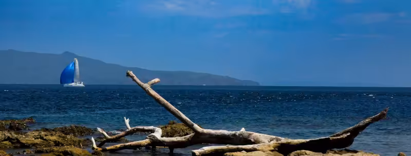
In the northeast corner of Luzon is the town of Santa Ana, Cagayan, where relatively sheltered anchorage can be found immediately East of the town. Just West of Santa Ana is Port Irene, which is the most nrtherly QIC check-in / check-out ports in the Philippines. Here you can explore the Marine Sanctuary and Eco-park around Palaui Island, and its historic Spanish-era lighthouse or, if you need to walk, you can trek into the foothills of the Sierra Madre mountain range - the longest mountain range in the Philippines, that extends South all the way to just East of Metro Manila. From Santa Ana you may wish to sail through the Babuyan Islands (as Captain Ahab did while pursuing Moby Dick, although he sailed the voyage West to East) or along the North Luzon coast, past Aparri and Claveria to Pagudpud. The challenge is that, after leaving Santa Ana, there is little shelter except in the Babuyan Islands - mostly exposed beaches along the Luzon coast and small headlands. You will observe the Philippines' most northerly wind-farm along the Pagudpud coast.
Turning South, after Pagudpud, you may anchor off Laoag City (home to the Philippines' most northerly international airport) or, continue on to imbibe the World Heritage Listed Spanish architecture featured in Vigan City. After Vigan City the breezes may be lighter (all the way to San Fernando) during the northeast monsoon because of the blocking effect of the Sierra Madre and other significant mountainous terrain that reaches almost to the coast in most areas - you may enjoy sea breezes during the day and offshore breezes (katabatic) in the evenings, if sailing close to the coast.
West Luzon
San Fernando, La Union
San Fernando is a popular location for check-in / check out of the Philippines and offers good anchorages at the Port, and also in the bay to the South of the City, fronting Bauang Beach. Note: for Bauang Beach you may want to hail a local fisherman to guide you inside the reef. From San Fernando your next stop will no doubt be southwest towards "100 Islands", Pangasinan. 100 Islands offers some stunning snorkeling experiences and is a good place to pause before reaching Bolinao . . . as is Anda Island, which some believe was the home of the legendary Princess Urduja. It is written (Ibn Batuta - a Moroccan born, Islamic lawyer turned 'travel writer', in 1347) that it was Princess Urduja who united the tribes of northern Luzon under the Kingdom of Tawalisi and received tribute from traders equivalent to that of the then Emperor of China . . . she is believed to have even been given an elephant as a gift by Middle Eastern traders (an elephant carcass was discovered on Anda Island late last century during excavation of foundations for a house - elephants have not been known to be present in the Philippines previously).
Bolinao, Pangasinan
Bolinao, for hundreds of years, was the major transit and trading port of the Philippines, supporting Middle East-China trade. It was the Spanish who moved the trade center to Manila because they felt it a more central location from which to govern and protect their new colony. Bolinao offers good anchorage (South and West of Santiago Island), reasonable shelter from stormy weather and a rich supply of seafood by virture of its close proximity to river, reef and deep-ocean marine environments, all within a few miles of the town.
From Bolinao you will probably be heading for Subic Bay but there are many islands to explore along the way . . . just be careful of the reefs between some islands as the charts are not quite accurate and daylight-only exploration is highly recommended.
Subic Bay, Zambales
For many sailors, Subic Bay is their first real experience of the Philippines when arriving from the North. The Bay was the strategic entry point for the US forces when they ousted the Spanish colonialists in 1898/99, and it became the primary US naval base to support their forays into Vietnam during the 1960s. Today Subic Bay features a container port, shipbuilding, yacht club, sailing club, haul-out facilities (for monohulls & catamarans), and many of the materials and skills-training that supported the US military are still available. Subic Bay, at least the eastern portion, still enjoys areas of pristine, forested hillsides where many Philippine indigenous species can still be found.
Subic Bay is home to Subic Sailing and the Subic Bay Yacht Club. The former is where most sailing events are organized and the latter is where most yachts are berthed because it is largely typhoon safe except if there was a direct hit. The other significant location in Subic Bay is Watercraft Venture, known for its travel-lift (for monohull yachts) and yacht repair facilities. If you own a catamaran or trimaran you may also want to know about Asia Pacific Marine Resources, where haul-out, repair and storage facilities are offered.
If you plan to enter the Bay please read our notes on Subic Bay - Restricted Areas
Manila Bay
You will probably not have much desire to sail far into Manila Bay as there is little to see of note during the 23 miles of water (from entry to port) until you reach the area immediately surrounding Manila Yacht Club. The Manila Yacht Club does not easily accept visitors unless in case of emergency or unless you are a Member of a reciprocal club, in which case you should contact the yacht club in advance to confirm space available for berthing (the club berths and moorings are usually full in any event). There is a recognized anchorage immediately North of the yacht club breakwater that can be used if you have a need to visit somewhere in Metro Manila.
The two places you may wish to visit at the mouth of Manila Bay are: (a) the Caylabne Bay Resort Marina (southern entrance to the Bay); and, (b) the historic Corregidor Island (northern entrance to the Bay).
Corregidor Island is where the US forces in Luzon finally surrendered to the Japanese in May 1942 and from where General Douglas MacArthur escaped South, by submarine, to Cagayan de Oro City (northern Mindanao) before flying out of the Philippines to Australia - much of the equipment and defensive structures that the US forces used are still visible today. If you are wishing to visit Corregidor Island then there is good anchorage on the North shore of the island, in the vicinity of the passenger ferry jetty.
Southern Luzon
Southern Luzon refers to the portion of Luzon Island South of Metro Manila, plus the significant islands of Burias, Masbate and Ticao.
West Coast Batangas
The west Coast for Batangas province, from Manila Bay South to Cape Santiago, initially offers many small bays and inlets where to shelter from storms or to simply anchor and relax. Before the Punta Fuego peninsula there are few habitations, but you may encounter many small fishing boats (bankas), especially at night.
Something worth remembering: a careful watch needs to be kept for these at night, as the most common fishing method employed by fisherfolk along the Batangas coast is to lay a net perpendicular to the coast, usually with the fisherman, on his banka, at the seaward end and a marker-buoy, lit with a candle, at the shoreward end. The fishermen are usually awake and will frantically signal with a flashlight if they perceive that you may run into their net. Look shoreward from the light flashing at you, detect the candle-lit buoy and make an obvious change of course to avoid passing between fisherman and his marker buoy. If you do run into their net, and if you have to cut the net to free your yacht, then you can expect to pay US$40-100 (Php equivalent) as compensation for the "damage" to the net.
Throughout the year, close to shore, you may witness resident Brahminy Kites (Haliastur indus - distinctive by their reddish body and wings, with white head and breast) soaring, circling and diving for their food. During winter months you may additionally see various migratory Terns, the most common being the Whiskered Tern (Chlidonias hybridus).
One place of interest perhaps along this part of the Batangas coast, if you have need for some yacht repairs, is Papaya Cove. The Cove is a little North of the Punta Fuego peninsula and offers good anchorage. It is a very sheltered anchorage, considered typhoon safe, and features the Papaya Yacht Charter Services boat maintenance yard, complete with an ex-America's Cup travel-lift that was imported from New Zealand . . . monohulls only.
The Punta Fuego peninsula is home to the Punta Fuego Yacht Club, a marina facility for mostly moneyed yacht owners. They offer a visitor-berth and an anchorage, but on any given day at arrival you may or may not find space available. Before you approach Punta Fuego Yacht Club you will probably pass inside the 'Twin Islands' - beware the shallow reef between the peninsula and the islands.
Immediately East of the Punta Fuego Yacht Club is a large bay offering good anchorage, especially in front of the former Maya Maya Yacht Club. The Maya Maya Yacht Club was sold some years ago with plans to develop it into a full-service marina for up to 50 yachts, but as at this time the plans have not been executed. If you do anchor overnight in the vicinity of the Maya Maya Yacht Club then in the early morning you may be visited by local fisherfolk offering freshly harvested lobster, crab and prawns at very sensible prices.
Continuing South along the West coast of Batangas you will pass the municipality of Nasugbu and from there South there are many beach resorts that sit behind the long barrier reef that extends up to a mile out from the shore. There are few places for anchorage here because of the reef, although there is an inlet good for anchorage at the southern end in the vicinity of Calatagan.
Cape Santiago is located at the western end of the Verde Island Passage and is renowned for strong tidal flows on an ebb-tide and, during a northeast monsoon, can deliver a short stretch of unpleasant, almost square waves during the flood tide. The tidal flow is noticeably East-to-West during the ebb and West-to-East during the flood.
South Coast Batangas
The South Coast of Batangas faces the Verde Island Passage. The Verde Island Passage was declared by the Smithsonian Institute as the World's "center of the center of marine biodiversity" and offers many underwater attractions once you have navigated Cape Santiago. Balayan Bay, the first bay into the Passage, has many townships along its shore but only at its eastern side, along the Anilao peninsula, is there really anything worth stopping for.
Anilao, and its southerly protective island of Maricaban, offers some of the best scuba diving in the Philippines. Whether you are into macro photography or prefer to witness coral diversity with large schools of fish, Anilao is one of the best places to swim, snorkel and dive. If you are interested in a good hike ashore then Maricaban Island has a footpath / bikepath that circumnavigates the island and will take you to two small, but stunning, beaches at its southwest corner.
Because of the vast diversity of coral and marine life here you are prohibited from anchoring along most of the Anilao coast, but most resorts have installed moorings that you may tie up to with permission. If you want to swim, snorkel or dive then the best option is to anchor near the ferry pier (North end of Anilao, and then take a dinghy (or road transport) to the resorts to the South).
Perhaps of interest, about a mile South of the ferry pier, is the home of the Philippine Olympic Windsurfing Team - because there is usually a predictable breeze entering the Bay from the northeast during the NE monsoon and from the southwest during the SW monsoon.
The next bay East is Batangas Bay, it is the location of the busy container and ferry Port of Batangas (goods and passengers traveling between Metro Manila and the Visayas mostly use this port). The Port of Batangas is a Philippine check-in / check-out port but cruising yachts have had a range of experiences with QIC there over the past four years, so it is not highly recommended (as at January 2025). The West coast of the Bay is largely featureless in terms of attractions; the North shore is administered by the Philippine Ports Authority, while the East coast of Batangas Bay is peppered with oil refineries and other commercial enterprises that require direct access to the sea for cargo un/loading.
At the southeastern point of Batangas Bay you cannot miss the huge "Mother Mary" statue that stands atop a religious retreat covering the southern extremity of the peninsula.
If you look South on exiting Batangas Bay you will see the peninsula of Puerto Galera, below the mountainous island of Mindoro. Puerto Galera is home to one of the most active yacht clubs for cruising yachts in the Philippines. More on that in the MIMAROPA section of this website.
The next island of interest will be Verde Island - the island that gives its name to the Passage - that separates Batangas province (and Luzon Island) from the island of Mindoro. Verde Island has few habitations, a handful of beach resorts but fronts (on its southern shore) the deepest parts of the Verde Island Passage. The Passage is up to 1000 meters deep and is formed by an active geological fault, which delivers frequent earthquakes to the surrounding areas. In recent memory the worst earthquake in the vicinity of the Verde Island Passage was of magnitude 7.1 (Richter scale) in November 1994 - it spawned a tsunami that caused significant damage along the eastern half of the Verde Island Passage coastline and Mindoro Island, reportedly killing at least 78 people and flattening hundreds of coastal structures.
Scuba diving off Verde Island can bring you face to face with some of the oceans largest marine mammals (the Passage is a migratory route for numerous whale specie) and some huge schools of fish. Verde island is also known for its "shark cave", where sharks can be found "sleeping" and, especially on its eastern end, (particularly) pieces of Chinese pottery from numerous wrecks that occurred on the East end of Verde Island over the centuries - the powerful NE monsoon winds, strong (and somewhat unpredictable) tidal flows and submerged rocks being the main cause. Anchorages can be found along the North and South shores of Verde Island although there is not much to explore on the island itself . . . just be cautious navigating around the eastern end of the island to avoid sandbars and submerged rocks.
East Coast Batangas
As you turn North and East from the exit of the Verde Island Passage you will come across the area of Laiya. Due to road improvements ashore during the early 2000s, the area of Laiya has become a vacation destination for the moderately wealthy from Metro Manila, and there are numerous resorts and 2nd-home housing development on or inland from the shore. Anchoring here is easy, with good holding on sand. Snorkeling over corals is an attraction near the headlands to the South and to the North of Laiya beaches. Need to stock up on coffee? In the public market of San Juan town, inland and North of Laiya by road, you can purchase roasted 'Batangas coffee' beans (they will grind them for you) at a sensible price.
While you can easily see the island of Marinduque to the East of you (more on that in the MIMAROPA section) your next destination may be Pagbilao Grande Island - the most northerly point of Tayabas Bay.