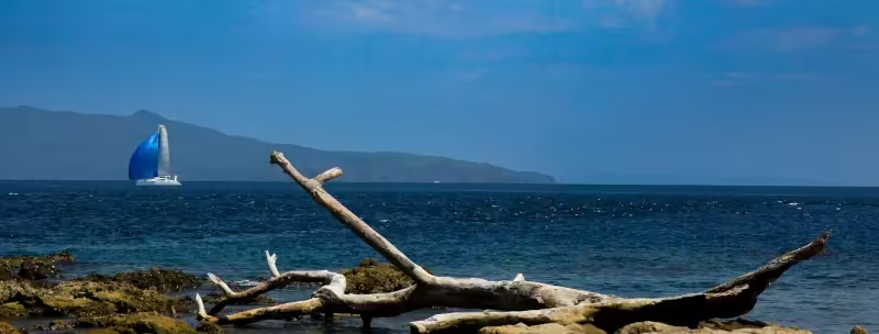
The Eastern Visayas includes the islands of Biliran, Leyte and Samar, with Tacloban City as the regional center.
You may approach the Eastern Visayas from the West Pacific and if you do then you can check-in to the Philippines at Tacloban on Leyte Island.
Samar Island
If you are seeking to explore a large Island with a mountainous, largely forested interior, including caves, waterfalls, indigenous animals, birds and plants, fringed by pristine beaches & coves, and largely off the modern tourist map then Samar Island could be the one.
The island of Samar itself is notable for, among other things, its geology, highlighted by the Langun-Gobingob Cave System – the largest cave system in the Philippines, covering 2,968 hectares within the Samar Island Natural Park. The Samar Island National Park is home to an estimated 10,000 plant species and 780 animal species, including many Philippine endangered endemics. The volume and diversity of species within the Park is mostly because it features six distinct forest habitats: beach forest, mangrove forest, lowland evergreen forest, forest over limestone, forest over ultrabasic rock, and lower montane forest.
The indigenous people of Samar are the Waray-Waray, known for their hospitality, culture and traditional weaving of grasses into colorful and resilient mats. The Waray-Waray have maintained their unique dialect and traditions despite the significant influence of Spanish & North American Christians, and the Japanese.
If you are approaching Samar Island from the South, through the Suirgao Strait, then you will most likely first arrive in the municipality of Guiuan.
Guiuan
Guiuan is at the the municipality at the southeastern tip of Samar and marks the northern perimeter of the entrance to the Leyte Gulf and the Surigao Strait. It includes three large islands and hundreds of islets with good anchorages along its western shores. Because it faces the Pacific Ocean, the East coast of Samar has many surfing locations but the most popular are on Calicoan Island, Guiuan.
Guiuan is famous for three notable landings: in 1521 Ferdinand Magellan stepped ashore on Homonhon Island; US Forces came ashore in October 1944, on their return to the Philippines during World War II, at the commencement of the "Battle of Leyte Gulf"; and, in November 2013, Super Typhoon Haiyan (Philippine name: Super Typhoon Yolanda), that currently holds the World record for the strongest tropical storm to ever hit land, barreled ashore at Guiuan, packing 300+Km/hr winds.
If instead of approaching the southern end of Samar Island, through the Surigao Strait, then you could alternatively have chosen the Northern end, through the San Bernardino Strait that separates Samar Island from the southern tip of Luzon. The San Bernardino Strait was the entry and exit point for the Spanish Galleon trade between the Philippines and Acapulco, Mexico, from 1565 until 1815.
If you are planning the San Bernardino Strait approach then yachts have recommended stopping at Biri Island off the Northeast corner of Samar. Reports suggest good anchorages with a very welcoming community of mostly fisherfolk living in a "remote island paradise".
Note: when choosing the San Bernardino Strait be aware that the tidal flows may be strong (2-3 knots) in either direction. We suggest checking Tidal Flows on windy.com when planning your passage through the Strait.
Leyte Island
The capital of Lyete Island is Tacloban City and one of the best places to check-in to the Philippines if arriving from the West Pacific.
Leyte Island, like is sister Samar Island, has a rugged interior and is separated from its sister by the navigable San Juanico Strait. The San Juanico Bridge connects the two sisters in the modern age with a navigable clearance of *** meters beneath. If entering the Philippines from the Pacific Ocean through the Surigao Strait then the city of Tacloban may be your check-in port to the Philippines; full QIC is available in Tacloban City as well as sheltered anchorages and a domestic airport - scheduled to become an international airport in 2027.
Historically, yachts arriving from equatorial Pacific locations and headed for Biliran, Masbate, Panay and Romblon have frequently used Tacloban as their check-in port to the Philippines. There is a yacht club under construction in Tacloban that will initially offer anchorage and moorings, with plans to eventually offer haul-out facilities as well.
A little South of Tacloban City, at Red Beach, Palo, is where General Douglas MacArthur stepped ashore on October 20, 1944 - three days after his forces landed at Guiuan, Samar - to mark his return to the Philippines and the beginning of the eventual removal of Japanese forces from the Philippine islands in 1945.
Unlike Samar Island, Leyte Island was not the traditional home to a single indigenous group before the arrival of the Spanish, but was instead home to multiple branches of indigenous groups from Mindanao and the other Visayan Islands. As a result, the population today speak a variety of dialects with Visayan and English being widely spoken making communication relatively easy for visiting yacht crews.
The forested mountains of Leyte Island made it a perfect home for the Philippine Eagle (Pithecophaga jefferyi) but habitat loss and human indifference eventually removed the last resident eagle by 2013. In 2024 a pair of Philippine Eagles, from the Philippine Eagle Sanctuary in Davao, were reintroduced in the Anonang-Lobi Mountain Range of Leyte, followed by three more Philippine Eagles in early 2025.
Leyte is also home to the indigenous Leyte tree-frog (Philautus leitensis) and a pitcher plant (Nepenthes leyte), plus many other Philippine-endemic flora and fauna.
The second major city on Leyte Island is Ormoc City, on the West coast. More recently acquiring the moniker of "The City of Beautiful People" - more due to their attitude to life than specific physical beauty - Ormoc City is a commercial and transportation hub for Leyte Island through its relatively sheltered bay and port, connecting it to the Central and Western Visayas and beyond. In the surrounding hills can be found many ecofriendly tourist attractions such as lakes, hot springs and nature trails. The sunsets observed from the southern reaches of Ormoc Bay are considered as beautiful as the people.
In November 1991 Ormoc, and Leyte Island in general, learned a very valuable lesson about the risks of rampant deforestation. As Tropical Storm Thelma (Philippine name: Typhoon Uring) passed over Leyte it deposited significant rains onto the mountains to the East of Ormoc City. The rivers burst their banks and eroded vast quantities of topsoil and rubble from the denuded forest areas into the city itself, the death toll was more than 4,000 people.
At the southernmost point of Leyte Island is Panaon Island. Panaon island is renowned for its exceptionally biodiverse marine ecosystems and also its importance as a observation point for sea turtles, whales and whale sharks that pass by the island, en-route from the Pacific Ocean towards the Sulu Sea, West Philippine Sea and beyond. In 2025, Panaon Island and its environs were named the "Panaon Island Protected Seascape". Be sure to contact Philippine Coast Guard to obtain permission to anchor around Panaon Island.
Biliran Island
You really should not bypass Biliran if cruising the North of Leyte or Samar.
Biliran Island is located immediately North of Leyte Island and is connected to it by a road bridge. The island has been formed by multiple volcanic eruptions and is basically the composite of sixteen volcanoes of which one is still classed as active. The last significant eruption was in 1668-69, when ash-falls reached as far South as Tacloban City; the last minor eruption occurred in 1939.
Biliran Island is a place of ancient legend, mostly related to a beautiful spirit-lady (a diwata) known as "Maria Benita", who is believed to have inhabited Mount Panamao in the North . . . and possibly still does.
Biliran consists of three main islands, of which Biliran is by far the largest, and a number of islets. The island group is known for its clear waters, marine bio-diversity and white-sand beaches, while Biliran Island itself is also known for its stunning waterfalls, hot and cold springs and natural swimming pools of various temperatures.
The main port is in the town of Naval on the West close but anchoring off almost every beach is acceptable if you follow best anchoring practices to avoid damage to corals.
Note: the bridge that connects Biliran Island to Leyte Island does not provide much clearance for tall-masted yachts.