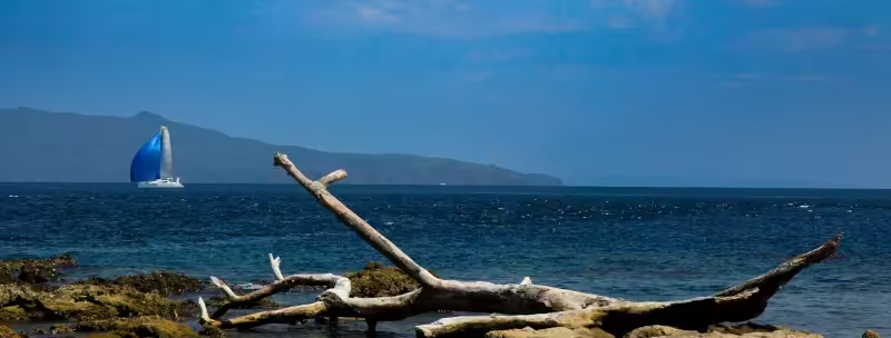
Southern Luzon refers to the portion of Luzon Island South of Metro Manila. starting in the province of Batangas. From Batangas you explore West Quezon and onward down the Bicol peninsula, embracing the significant islands of Burias, Masbate and Ticao, to Sorsogon, before rounding up the Eastern seaboard until finally arriving at East Quezon.
In the water you can view whale sharks, manta rays and so much more. Ashore you find culture and history, stunning sunset beaches, endemic birds and animals, a pristine beach from where to kiteboard and you can even join in a rodeo.
West Coast Batangas
The West coast for Batangas province, from Manila Bay South to Cape Santiago, initially offers many small bays and inlets where to shelter from storms or to simply anchor and relax. Before the Punta Fuego peninsula there are few habitations, but you may encounter many small fishing boats (bankas), especially at night.
Something worth remembering: a careful watch needs to be kept for these at night, as the most common fishing method employed by fisherfolk along the Batangas coast is to lay a net perpendicular to the coast, usually with the fisherman in his banka at the seaward end with and a small marker-buoy, lit with a candle, at the shoreward end. The fishermen are usually awake and will frantically signal with a flashlight if they perceive that you may run into their net. Look shoreward from the light flashing at you, detect the candle-lit buoy and make an obvious change of course to avoid passing between fisherman and his marker-buoy. If you do run into their net, and if you have to cut the net to free your keel or rudder, then you can expect to pay US$40-100 (Php equivalent) as compensation for the "damage" to the net.
Throughout the year, especially late afternoon and close to shore, you may witness resident Brahminy Kites (Haliastur indus) - distinctive by their reddish body and wings, with white head and breast) soaring, circling and diving for their food. During winter months you may additionally see various migratory Terns, the most common being the Whiskered Tern (Chlidonias hybridus).
One place of interest to cruising yachts along this part of the Batangas coast, if you have need for some yacht repairs, is Papaya Cove. Papaya Cove is a little North of the Punta Fuego peninsula and offers good anchorage. It is a very sheltered anchorage, considered typhoon safe, and features the Papaya Yacht Charter Services boat maintenance yard, complete with an ex-America's Cup travel-lift that was imported from New Zealand . . . monohulls only.
The Punta Fuego peninsula is home to the Punta Fuego Yacht Club, a marina facility for mostly moneyed yacht owners. They offer a visitor-berth and an anchorage, but on any given day at arrival you may or may not find space available. Before you approach Punta Fuego Yacht Club you will probably pass inside the 'Twin Islands' - beware the shallow reef between the peninsula and the islands.
Immediately East of the Punta Fuego Yacht Club is a large bay offering good anchorage for cruising yachts, especially in front of the former Maya Maya Yacht Club. The Maya Maya Yacht Club was sold some years ago with plans to develop it into a full-service yacht marina for up to 50 yachts, but as at this time the plans have not been executed. If you do anchor overnight in the vicinity of the Maya Maya Yacht Club then in the early morning as a cruising yacht you may be visited by local fisherfolk offering freshly harvested lobster, crab and prawns at very sensible prices.
Continuing South along the West coast of Batangas you will pass the municipality of Nasugbu to port and from there South there are many beach resorts that sit behind the long barrier reef that extends up to a mile out from the shore. There are few places for anchorage here because of the reef, although there is an inlet good for anchorage at the southern end in the vicinity of Calatagan.
West of Nasugbu is Fortune Island. Notable for its resort where iconic Greek edifices have been erected, but where nobody is welcome to anchor-off and go ashore unless you have made prior arrangement.
Cape Santiago is located at the Western end of the Verde Island Passage and is renowned for strong tidal flows on an ebb-tide and, during a Northeast monsoon, can deliver a short stretch of unpleasant, almost square waves during the flood tide. The tidal flow is noticeably East-to-West during the ebb and West-to-East during the flood.
South Coast Batangas
The South Coast of Batangas faces the Verde Island Passage. The Verde Island Passage was declared by the Smithsonian Institute as the "World's center of the center of marine biodiversity" and offers many underwater attractions once you have navigated Cape Santiago. Balayan Bay, the first bay into the Passage, has many townships along its shore but only at its Eastern side, along the Anilao peninsula, is there really anything worth stopping for.
Anilao
Anilao, and its southerly protective island of Maricaban, offers some of the best scuba diving in the Philippines. Whether you are into macro photography or prefer to witness coral diversity with large schools of fish, Anilao is one of the best places to swim, snorkel and dive. If you are interested in a good hike ashore then Maricaban Island has a footpath / bikepath that circumnavigates the island and will take you to two small, but stunning, beaches at its southwest corner.
Because of the vast diversity of coral and marine life here cruising yachts are prohibited from anchoring along most of the Anilao coast, but most resorts have installed moorings that you may tie up to with permission. If you want to swim, snorkel or dive then the best option is to anchor near the ferry pier (North end of Anilao), and then take a dinghy (or road transport) to the resorts to the South).
Perhaps of interest, about a mile South of the ferry pier, is the home of the Philippine Olympic Windsurfing Team - because there is usually a predictable breeze entering the Balayan Bay from the Northeast during the Northeast monsoon and from the Southwest during the Southwest monsoon.
Batangas Bay
The next bay East is Batangas Bay, it is the location of the busy container and ferry Port of Batangas (goods and passengers traveling between Metro Manila and the Central and Western Visayas mostly use this port). The Port of Batangas is a Philippine check-in / check-out port for visiting yachts but cruising yachts have had a range of experiences with QIC there in recent years, so it is not highly recommended (as at January 2026). The West coast of Batangas Bay is largely featureless in terms of attractions; the North shore is administered by the Philippine Ports Authority, while the East coast of Batangas Bay is peppered with oil refineries and other commercial enterprises that require direct access to the sea for cargo un/loading.
At the Southeastern point of Batangas Bay you cannot miss the huge "Mother Mary" at Southern extremity of the peninsula.
If you look South on exiting Batangas Bay you will see the peninsula of Puerto Galera, below the mountainous island of Mindoro. Puerto Galera is home to one of the most active yacht clubs for cruising yachts in the Philippines. More on that in the Sail Mindoro section of this website.
Verde Island
The next island of interest will be Verde Island - the island that gives its name to the Verde Island Passage - that separates Batangas province (and Luzon Island) from the island of Mindoro. Verde Island has few habitations, a handful of beach resorts but fronts (on its Southern shore) the deepest parts of the Verde Island Passage. The Passage is up to 1000 meters deep and is formed by an active geological fault, which delivers frequent earthquakes to the surrounding areas. In recent memory the worst earthquake in the vicinity of the Verde Island Passage was of magnitude 7.1 (Richter scale) in November 1994 - it spawned a tsunami that caused significant damage along the eastern half of the Verde Island Passage coastline and Mindoro Island, reportedly killing at least 78 people and flattening hundreds of coastal structures.
Scuba diving off Verde Island can bring you face to face with some of the oceans largest marine mammals (the Verde Island Passage is a migratory route for numerous whale specie) and some huge schools of fish. Verde island is also known for its "shark cave", where sharks can be found "sleeping" and, especially on its Eastern end, (particularly) pieces of Chinese pottery from numerous wrecks that occurred on the East end of Verde Island over the centuries - the powerful Northeast monsoon winds, strong (and somewhat unpredictable) tidal flows and submerged rocks being the main cause of the wrecks. Anchorages can be found along the North and South shores of Verde Island although there is not much to explore on the island itself . . . just be cautious navigating around the eastern end of the island to avoid sandbars and submerged rocks.
East Coast Batangas
As you turn North and East from the exit of the Verde Island Passage you will come across the area of Laiya. Due to road improvements ashore during the early 2000s, the area of Laiya has become a vacation destination for the moderately wealthy from Metro Manila, and there are numerous resorts and 2nd-home housing developments on or inland from the shore. Anchoring here for cruising yachts is easy, with good holding on sand. Snorkeling over corals is an attraction near the headlands to the South and to the North of Laiya beaches. Need to stock up on coffee? In the public market of San Juan town, inland and North of Laiya by road, you can purchase roasted 'Batangas coffee' beans (they will grind them for you) at a sensible price.
While you can easily see the island of Marinduque to the East of you (more on that in the MIMAROPA section) your next destination may be Pagbilao Grande Island - the most northerly point of Tayabas Bay.
South Coast Quezon
After leaving the vicinity of San Juan and Laiya you will be passing into Quezon province, or at least the southern shores thereof. The first significant habitation is Lucena City – the capital of Quezon province. Apart from perhaps stocking up on essential food items there is not much reason to stop at Lucena as the port can get rather busy with passenger ferries and cargo vessels, and you will probably press on to the area of Pagbilao Grande and Pagbilao Chica islands in Padre Burgos.
Padre Burgos
The "Isla Grande" and "Isla Chica" (as they are known in local narrative) islands of Padre Burgos, just East of Lucena City, are far from the busy shipping lanes and worth visiting if you want to see a more laid back, quiet coastal region of South Luzon. The islands feature several small resorts where you can anchor off and are known for good seafood and long walkable beachfronts.
Some natural sites worth exploring while in Padre Burgos are the Pagbilao Bilaran Sandbar and the Kwebang Lampas Caves. If you do venture ashore or you have friends arriving needing a place to stay then check out the accommodations at the Isla Chica Eco Resort or the Borawan camping site. Note: the Isla Chico Eco Resort also has sailing dinghies to rent.
Voyaging South from Padre Burgos you will see many beaches with small fishing communities and the occasional beach resort. Most of the Southern portion of Quezon province is forested and is home to endemic monkeys, hornbills, spiders and snakes (some highly venomous), so if you are interested to explore ashore then you can probably tick-off a few wildlife Bucket List items.
Cruising South along the coast of Quezon Province takes you past the dramatic, indented coastline of the Bondoc Peninsula and into the pristine marine environments of the Ragay Gulf.
Ragay Gulf
One potentially interesting area for ancient history lovers, about 35NM South along the coast from Padre Burgos, will be found in the small Matandang Sabang Kanluran peninsula, just North of Catanauan town. It is in this area that burial jars have been discovered in at least three distinct locations, some buria jars containing the bones of up to four individuals. The bones have been dated to between 1000 and 2000 years ago, which implies a long-standing tradition. Along with the jars are wooden and limestone carved boat shapes, interpreted as either, symbols of the watercraft of the time or, a belief in a need for vessels to aid the soul to travel to another dimension . . . nobody has yet found a definitive answer.
As you cruise further South along the rugged coast of the Bondoc Peninsula, the landscape transitions into remote, untouched ecotourism gems.
"Alibijaban Island", San Andres is located near the southern tip of the Bondoc Peninsula, this is a highlight of a Southern Quezon province cruise. Alibijaban Island is celebrated for its lush, sprawling mangrove forests, pristine white sandbars and highly vibrant coral reefs teeming with marine life. Note: Alibijaban Island is mostly surrounded by a protected marine sanctuary so you will either, have to anchor off San Andres and take you dinghy for exploration or, find a local guide who can direct you to a non-protected location for anchoring.
The Ragay Gulf in general is home to an impressive array of marine life for three reasons: (a) it is up to 200 meters deep along the East coast; (b) its mostly mangrove-lined shores offer shelter for spawning fish; and, (c) it opens into the Burias Pass, which is part of the migratory route for Pacific Ocean fish (such as whale sharks and manta rays) and mammals (various whale species) heading for the West Philippine Sea and the South China Sea, North or South around Mindoro Island.
Masbate
At this point, if sailing South and still focused on South Luzon, then you may want to explore a little of the Masbate Island group of which Burias Island is first. Masbate consists of three main islands: Burias, Ticao and Masbate.
Burias Island
"Burias Island" is actually surrounded by its own islets of either, dramatic limestone formations or, flatter outcrops surrounded by white-sand beaches. Ambulong island is the most dramatically shaped and features many rock pools to explore. Sombrero Island, similar to its namesake cousin in the Verde Island Passage, is shaped like a sombrero and, also like it cousin, is surrounded by clear waters and pristine corals. Note: if you plan on stopping at Burias Island please be aware that it has not quite caught up with the digital age, so Internet over mobile phone networks is very limited, and there are no ATMs on the island at this time (2026), so better prepare some cash in advance.
Ticao Island
"Ticao Island" has about the same area of Burias Island but is more popular for visitors and has a larger population (and it has ATMs). Ticao Island has the reputation as the birthplace of some of the most beautiful women in the Philippines but the big underwater attraction of Ticao Island is the "Manta Bowl". As its name suggests the Manta Bowl is where manta rays can be found; it is a cleaning station for manta rays and also for whale sharks, thresher sharks, and hammerheads. Diving at the Manta Bowl off Ticao Island offers the opportunity of diving with some of the ocean's largest fish.
If there is one other remarkable feature of Ticao Island it is the Catandayagan Falls. Located about one third of the way down the West coast of the island, the Catandayagan Falls cascade down a 100 meter vertical cliff directly into the sea within the Masbate Pass. These "ocean falls" at Catandayagan are one of only around 40 such waterfalls, ocean falls directly into the sea, around the Globe.
Masbate Island
"Masbate Island" itself is the largest of the three main islands and is known as the "Rodeo Capital of the Philippines". For at least 400 years, beef cattle have been reared on Masbate Island and with the influence of the US colonialists around the turn of the 20th century Masbate has organized annual rodeos that attract prime-beef buyers and tourists.
The Southwest peninsula coast of the municipality of Balud is perhaps the most beautiful and interesting part of the island. Balud is relatively sparsely populated, features large areas of wetlands, where Philippine endemic birds share space with migrant birds and endemic snakes, plus it has a long white-sand beach with sunsets to rival its more famous cousin, Boracay.
The long reef off Balud's West coast is home to crabs, crayfish and lobster. So, combined with the abundance of beef ashore, it no surprise that Balud is the cheapest place to find the ingredients for a good Surf & Turf supper. Close to the bottom of the peninsula the reef comes in close to the cliffs and a small sandy beach where turtles come ashore to lay their eggs. The best places to anchor off Balud are in Looc Bay or Nin Bay, at the North end of the reef.
Jintotolo Island
To the South of Balud peninsula is Jintotolo Island; you can sail and anchor there or take a local ferry from the Southern tip of the Balud peninsula. If you are interested in historic buildings then Jintotolo Island has one of the oldest Spanish lighthouses in the Philippines, reportedly originally built to guide the Spanish galleons around the tip of the island before they headed to the San Bernardino Strait and out across the Pacific to Mexico. Today the lighthouse is solar powered and no lighthouse keeper is required so the buildings are just empty shells, but the view of the reef from the top of the tower and the open expanse of the Jintotolo Strait, that links the Sibuyan Sea to the Visayan Sea, has not changed.
Note: if you have your kiteboarding gear aboard and you want somewhere to ride, glide, carve, jump and fly, where there is nobody else to obstruct you, then the Northeast corner shore of Jintotolo Island provides absolutely perfect kiteboarding conditions during the Northeast Monsoon (November to April). The kilometer-long, wide, sandy beach faces Northeast so you have an uninterrupted, on-shore breeze; the outer reef, that diminishes most of the waves, is between 150-250 meters from shore; the waters within the reef are 1-4 meters deep. And, the beach is hardly developed, is owned by one person who is happy to have people use it for a small fee.
From Balud or Ticao you will probably want to explore Sorsogon province at the southernmost tip of Luzon Island and then navigate the San Bernardino Strait.
Sorsogon
Due North of the Northern tip of Ticao Island is Donsol, Sorsogon.
Donsol
Donsol has for the longest time been know as the "Whale Shark Capital of the World" for it is here that these large, majestic, filter-feeder fish can be observed close-up. The whale sharks congregate where the Donsol River discharges its nutrient-rich waters into the sea, attracting dense blooms of plankton and other small marine organisms = food for whale sharks. Globally famous for the option to swim with whale sharks (local name: butanding; pronouced 'boo-tan-ding'), the largest gathering of whale sharks around Donsol occurs during their annual migration around the West Pacific Ocean, from November to June, with the largest numbers observable from February to April each year. Best advice for this Bucket List item is to anchor off Donsol and take a local tourist boat with guide.
If you did not dive the Manta Bowl while exploring Masbate then now may be the time as the Manta Bowl is only about 15NM Southeast of Donsol.
San Bernardino Strait
Between the Southern tip of Masbate and the San Bernardino Strait are a few islands where you may want to stop to explore. These islands are actually part of the province of Samar but we will especially mention the San Vicente island group because it is most frequently visited by tourist boats from Matnog, Sorsogon. In particular you may want to visit Sila Island (due East from the Southern tip of Ticao Island), to walk along its pink-sand beach.
The San Bernardino Strait is one of the two narrow waterways through which the Pacific Ocean interacts with the West Philippines Sea and the South China Sea. The result can be some tidal flows that may either, keep your yacht geographically stationary or, provide a welcome boost of speed, depending on the phase and altitude of the moon. Best advice is to choose a time when the tidal flow favors your intended direction because the volume of shipping (cargo and passenger) between Matnog Port and Samar can be intimidating.
When entering the San Bernardino Strait from the West then Subic Beach on Calintaan Island, off the Southern tip of Sorsogon, may please your camera and it is locally famous for its pink-sand beach.
As you head North along the East Sorsogon coast you may want to stop at Gubat where, especially during the Northeast Monsoon (November to April) the sand bars off the coast provide some inspiring surfing opportunities. And the onward to the Albay Gulf.
Bicol
Albay Gulf
Most evident in the Northwest corner of the Albay Gulf is the world famous Mayon Volcano. Long renowned as the most "perfect cone volcano", Mount Mayon is still active today and offers some memorable photographic opportunities during its eruptions.
The Albay Gulf is surrounded by many mangrove fringed islands and offers at least 16 recognized dive sites. Whale sharks passing to / from Donsol are frequently observed in the Gulf and the entire Albay Gulf provides for most of the seafood available in the towns and villages dotted around its shores.
Of note perhaps along the North coast of the Albay Gulf are the Pototan and Minaroso limestone cave systems that you can explore on Batan Island, Rapu-Rapu. Pototan Cave is known for picturesque river that flows through the cave system. Minaroso cave is best known for its resident populations of nesting birds.
At the head of the Albay Gulf is Legazpi City. If you need to stock up on essentials then Legazpi City is a good place to do it. If you would like assistance finding what you desire then you can call on the resident knowledge-base of members of the very friendly Albay Yacht Club, located along the Legazpi City waterfront. You may also enjoy participating the yacht club's fairly regular, weekend dinghy sailing events where they mostly use the Australian-designed-for-Philippines Oz Goose sailing dinghies.
North of Albay Gulf is the Catanduanes Island and the Caramoan peninsula and island group.
Camarines Sur
Catanduanes Island
The island of Catanduanes if known for happiness and abaca, although not necessarily related. Catanduanes Island is known as the "Happy Island" mostly because of its prominent location with an uninterrupted view of the Pacific Ocean. The Pacific Ocean provides generous swells, offering superb surfing opportunities that reduce stress and anxiety, which is most useful because Catanduanes Island is affected by a disproportionate (compared to most other East coast locations) number of Pacific storms each year. Catanduanes Island is also widely known for its natural beauty and cascading waterfalls.
The connection to abaca is real. Catanduanes Island is called the "Abaca Capital of the World". Abaca is Manila Hemp - a remarkably resilient and strong, natural fiber derived from a specie of banana found only in the Philippines. For centuries abaca / Manila Hemp was used to make the ropes, lines and rodes that enabled sailing ships to travel the globe with the confidence that the ropes and lines would not break under strain. Although not as significant in the modern world of synthetic fibers, Manila Hemp is still in demand for niche applications where high-strength rope is called for and where natural-fiber cloth is required.
There are numerous sheltered anchorages around Catanduanes Island, especially on the West side and away from the Northeast monsoon breezes.
Caramoan
Caramoan is a peninsula beside a group of small islands located to the Northwest of Catanduanes Island. Its entirety is notable for its sometimes dramatic limestone (and other karst rock) formations that liken it to similar Southeast Asia island areas, especially those of Thailand.
The islands of Caramoan offer the adventure seeker the opportunity for snorkeling and scuba diving plus kayaking, rock-climbing and caving (a.k.a. spelunking)
In recent times Caramoan has become famous as a location for the filming of various international editions of the "Survivor" television series, but it has always been one of those places off-the-usual tourist track that offers multiple small, picturesque white-sand beaches and coves to escape to.
Onward to the North and the last place you may stop in South Luzon, before heading out to Guam or Japan, is Polillo Island.
East Quezon
Polillo Island
If you wanted to visit just one island in South Luzon that is renowned for its native beauty, indigenous wildlife and friendly people it would probably be Polillo Island. The island derives its name from pre-colonial times when Chinese, Malay and Hindu merchants came to trade there; Polillo, as it is written today, comes from the phonetic "Pulilu" - a Chinese expression describing 'a beautiful island with abundant food'.
Off the East coast of Quezon province the Polillo Island group is also renowned as the island location that sees more Pacific storms overhead than any other island group in the Philippines. This is the primary reasons why, despite its beauty and its relative close proximity to Metro Manila, it is one of the least developed Philippine islands and why its wildlife is largely immune to the effects of modern tourism – Polillo Island is home to a 5-star resort hotel.
Nature lovers know Polillo as the home of the large, Grays monitor lizard (Varanus olivaceus), also known as the Butaan Lizard, that shares the island habitat with Polillo-endemic bird species (a goshawk, two parrots, a trogon, a hornbill and a woodpecker) plus Philippine-endemic birds (a kingfisher, a pigeon, an oriole, a sunbird, two flycatchers and a cockatoo). Birders visiting have recorded as many as 47 different species and sub-species within the Polillo Island group.